Maps
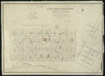
1843 Plan of Richmond by Robert Hoddle
The map shows Collingwood and Richmond subdivided into allotments. The Richmond allotments are inscribed with the names of the original purchasers. To the west of Richmond the part of East Melbourne south of Wellington Parade is shown.
- 2407 reads
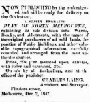
1847 Plan of North Melbourne by Charles Laing
The map shows the city of Melbourne with names of orginal purchasers marked. Public buildings are also marked. The western edge of the proposed East Melbourne is shown with streets marked with a set of names very different from the eventual names used.
The map is in the collection of the State Library of Victoria and its citation is below:
- 2601 reads
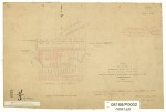
1848 Plan of Parish of Jika Jika
The map shows Richmond subdivided into allotments with names of first purchasers inscribed. To the west of Richmond lies the as yet undeveloped East Melbourne, south of Wellington Parade. The edge of the Government Paddock is shown.
- 3297 reads
1856 Plan of Eastern Hill
Map shows Eastern Hill marked with churches and public buildings. The map shows some buildings which have been all but forgotten such as the Police Barracks, the Reservoir and Apsley Place.
- 2679 reads
1857 Design for Fitzroy Square by E L Bateman
A plan showing the proposed design for the laying out of the Fitzroy Gardens by Edward La Trobe Bateman. The plan was commissioned by the City of Melbourne. The Age of 1 Jun 1858 reported on a Council meeting the previous day in which it was agreed, after some debate, to pay Bateman £100 for his work, which also included a plan for the Carlton Gardens.
- 2235 reads
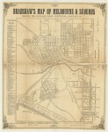
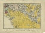
1859 Geological Survey Map
The map shows the central city grid and suburbs to the south and east, including East Melbourne. The caption beneath the map reads 'Surveyed, Engraved & Published under the direction of Alfred R C Selwyn, Govt Geologist'.
- 3301 reads
1859 Plan of East Melbourne
A map of East Melbourne showing original purchasers' names, land granted to churches, land reserved for public use. Capt Lonsdale's house is shown, as is Latrobe's Jolimont. It shows an early scheme for the Fitzroy Gardens and old street names such as Fitzroy Street for Hotham Street.
- 1999 reads
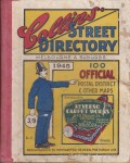
Collins Street Directory - 1945
Street directory of Melbourne and Suburbs. One page per suburb. Includes fold out map of city and suburban streets.
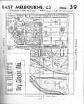
East Melbourne page shows Grey Street West and Gipps Street West, now Cathedral Place and St Andrews Place respectively.
Map also shows schools: Scotch College, St Patrick's College, Christian Brothers College and Presbyterian Ladies' College
- 3455 reads
Jolimont 1879
An edited extract from an article entitled 'Typhoid fever connected with milk supply' [see VF71]. Gives a colourful description of Jolimont and dairy practices of the time. In East Melbourne Historical Society Newsletter, February 2005.
- 3569 reads


