1859 Plan of East Melbourne
- first
- ‹ previous
- 2047 of 2412
- next ›
- last
Move your mouse over image or click to enlarge
Acquisition number:
1560
Catalogue number:
emdf0347
File name:
DF0347
File location:
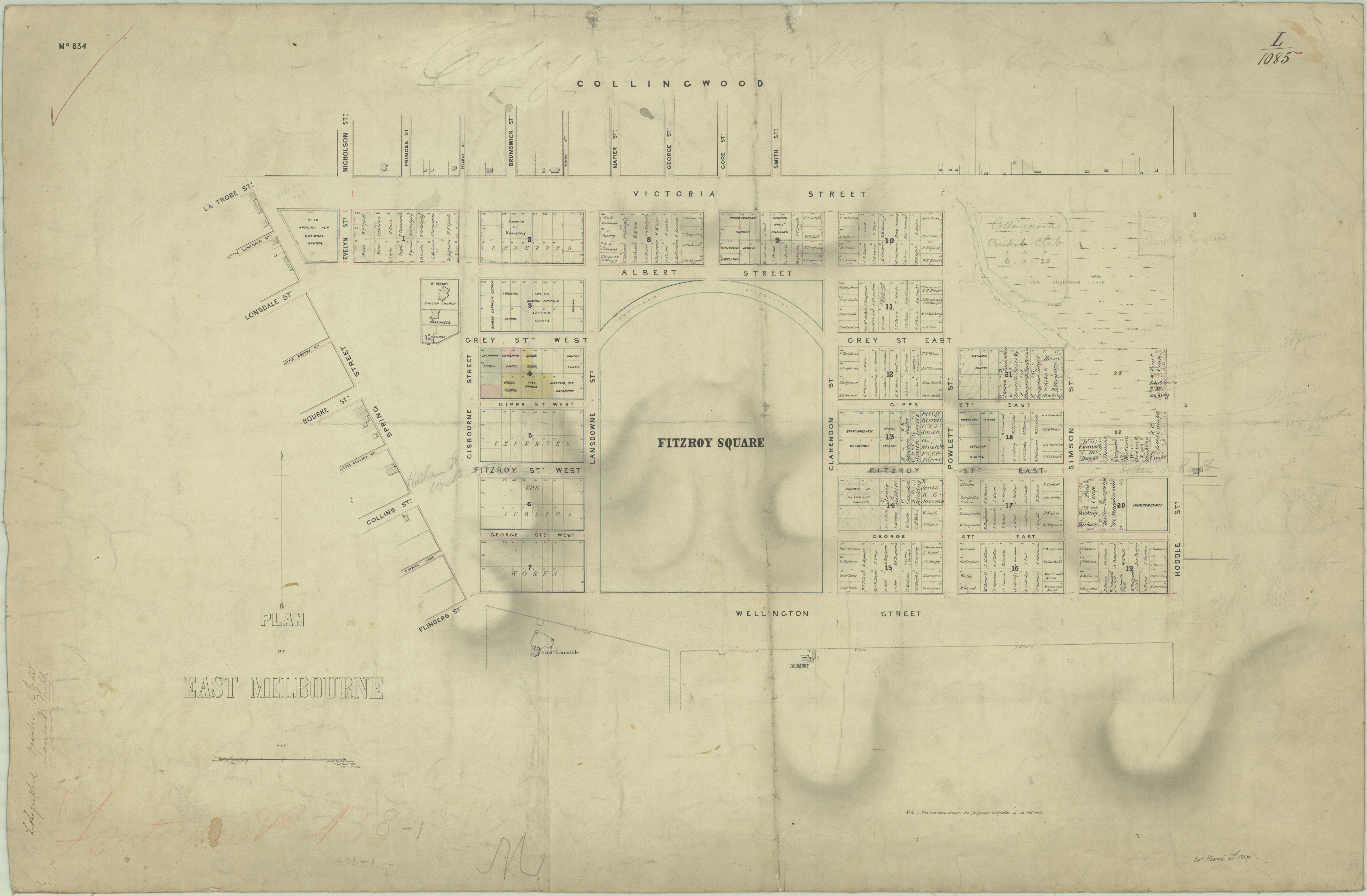
Digital archive A map of East Melbourne showing original purchasers' names, land granted to churches, land reserved for public use. Capt Lonsdale's house is shown, as is Latrobe's Jolimont. It shows an early scheme for the Fitzroy Gardens and old street names such as Fitzroy Street for Hotham Street.
The original map is in the collection of the Public Records Office of Victoria, in its Historic Plan Collection. Surveyor-general's department: VPRS 8168/P5 Item FEAT, record 438-1
Search term: FEAT 348-1: EAST MELBOURNE; P.W. INSTITUTIONS
Item type:
Map
Date of publication or creation:
1850
Owner of original:
Public Records Office of Victoria