Home

East Melbourne Historical Society

Drop-down menu

  • Articles
  • People
    • Notable Women
    • WW1 soldiers and nurses
    • WW1 nurses
  • History
    • Milestones
    • Buildings
    • Community
    • People
  • Gallery
    • Maps
    • MMBW plans
    • Abortion battles
    • Bishopscourt
    • Bishopscourt garden
    • Bomb shelter
    • Buildings
    • Cairns Memorial Church
    • Early Melbourne
    • Football
    • Jean Campbell
    • Lanes
    • Margaret McLean
      • Family and home
      • Female suffrage
      • Clippings - Australia
      • Clippings - Britain
      • Clippings - USA
    • Personalities
    • Yarra Park
      • History
      • Desecration
    • Yarra River
  • Catalogue
    • Browse and Search
    • Catalogue table view
    • Site images
  • Images
  • Society
    • Activities
    • Newsletters
    • Tributes
      • John Barrie Wykes
      • Wynne McGrath
    • Publications
      • Heritage Matters
      • What's in a Name
    • About
Home
    • Home
    • Search
    • Forum
    • Contact

1847 Plan of North Melbourne by Charles Laing

Subjects

  • Early East Melbourne
  • Maps
  • Plans
  • Streets
  • first
  • ‹ previous
  • 2045 of 2369
  • next ›
  • last
Image
Move your mouse over image or click to enlarge
Image
Move your mouse over image or click to enlarge
Acquisition number: 
1559
Catalogue number: 
emdf0346
File name: 
DF0346
File location: 
Digital archive

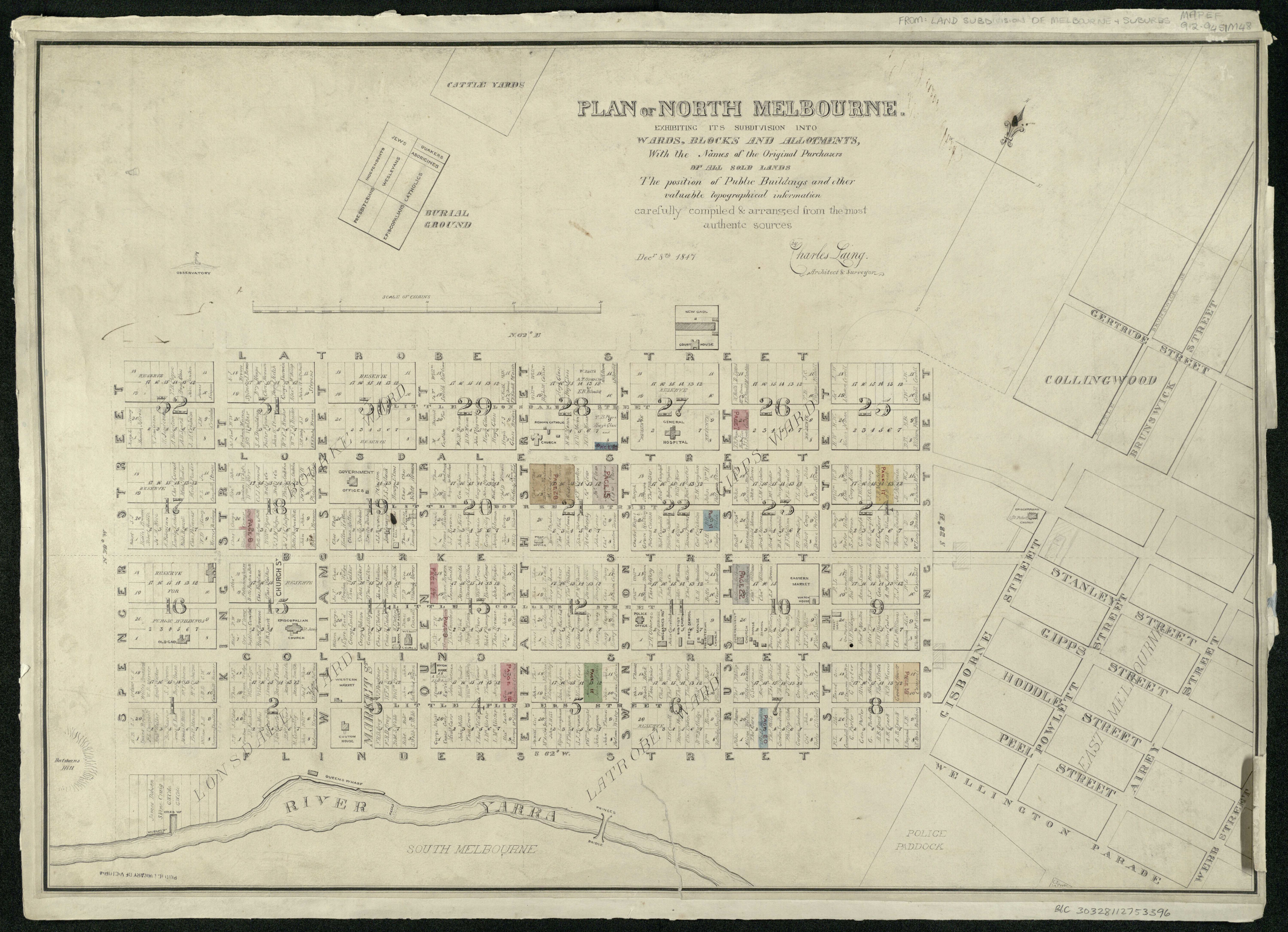
The map shows the city of Melbourne with names of orginal purchasers marked.  Public buildings are also marked.  The western edge of the proposed East Melbourne is shown with streets marked with a set of names very different from the eventual names used.

The map is in the collection of the State Library of Victoria and its citation is below:

Plan of North Melbourne : exhibiting its subdivision into wards, blocks and allotments, with the names of the original purchasers of all sold lands, the position of public buildings and other valuable topographical information / carefully compiled & arranged from the most authentic sources, Decr. 8th, 1847 by Charles Laing, architect & surveyor.

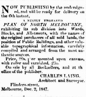
An advertisement from Port Phillip Gazette and Settlers Journal 25 Dec 1847, p.3 shows that the plan was available for purchase.

Item type: 
Map
External reference: 
State Library of Victoria link
Artist-illustrator: 
Charles Laing
Date of publication or creation: 
1847
Owner of original: 
State Library of Victoria
  • 2045 reads
  • Share this
  • PrintPrint
  • EmailEmail

User login

  • Join EMHS
  • Request new password
  • Privacy
  • Membership
  • About
  • Contact
  • Guidelines