Map of East Melbourne 1858
- first
- ‹ previous
- 777 of 2412
- next ›
- last
Move your mouse over image or click to enlarge
Acquisition number:
724
Catalogue number:
empf0019
File name:
PF19
File location:
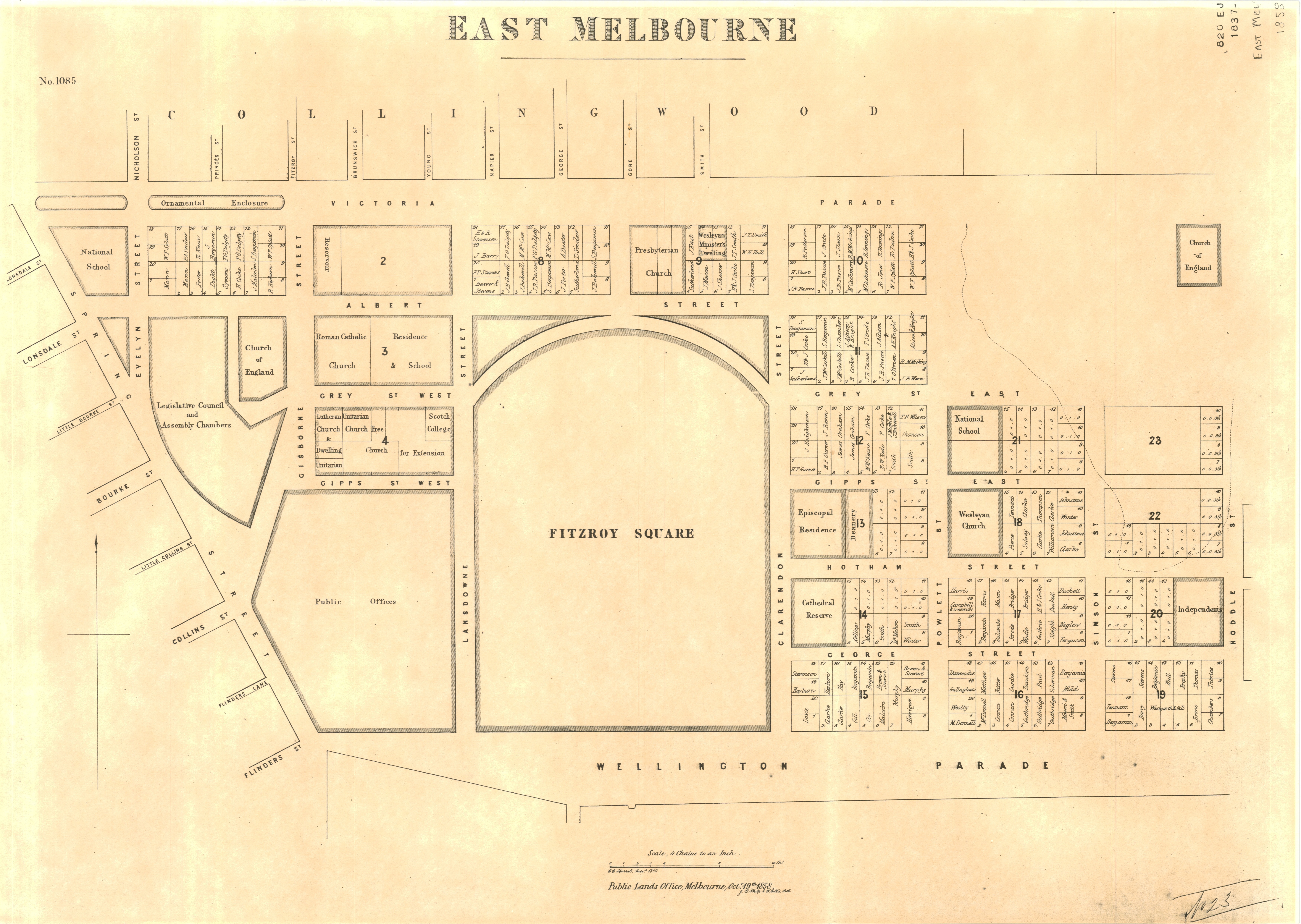
Plan file Map of East Melbourne based on 1850 survey by C.C. Horrel. Scale 4 chains to the inch. Published by the Public Lands Office Melbourne in 1858. Lithograph by J.B.Philp and W. Hollis.
Properties and owners are marked.
Item type:
Map
Item size:
60x41 cm
Item condition:
Good copy
Date of publication or creation:
1858-10-19
Publisher:
Public Lands Office
Publication place:
Melbourne
Date digitised:
2010-02-26