Move your mouse over image or click to enlarge
Acquisition number:
655
Catalogue number:
empf0014
File name:
PF14
File location:
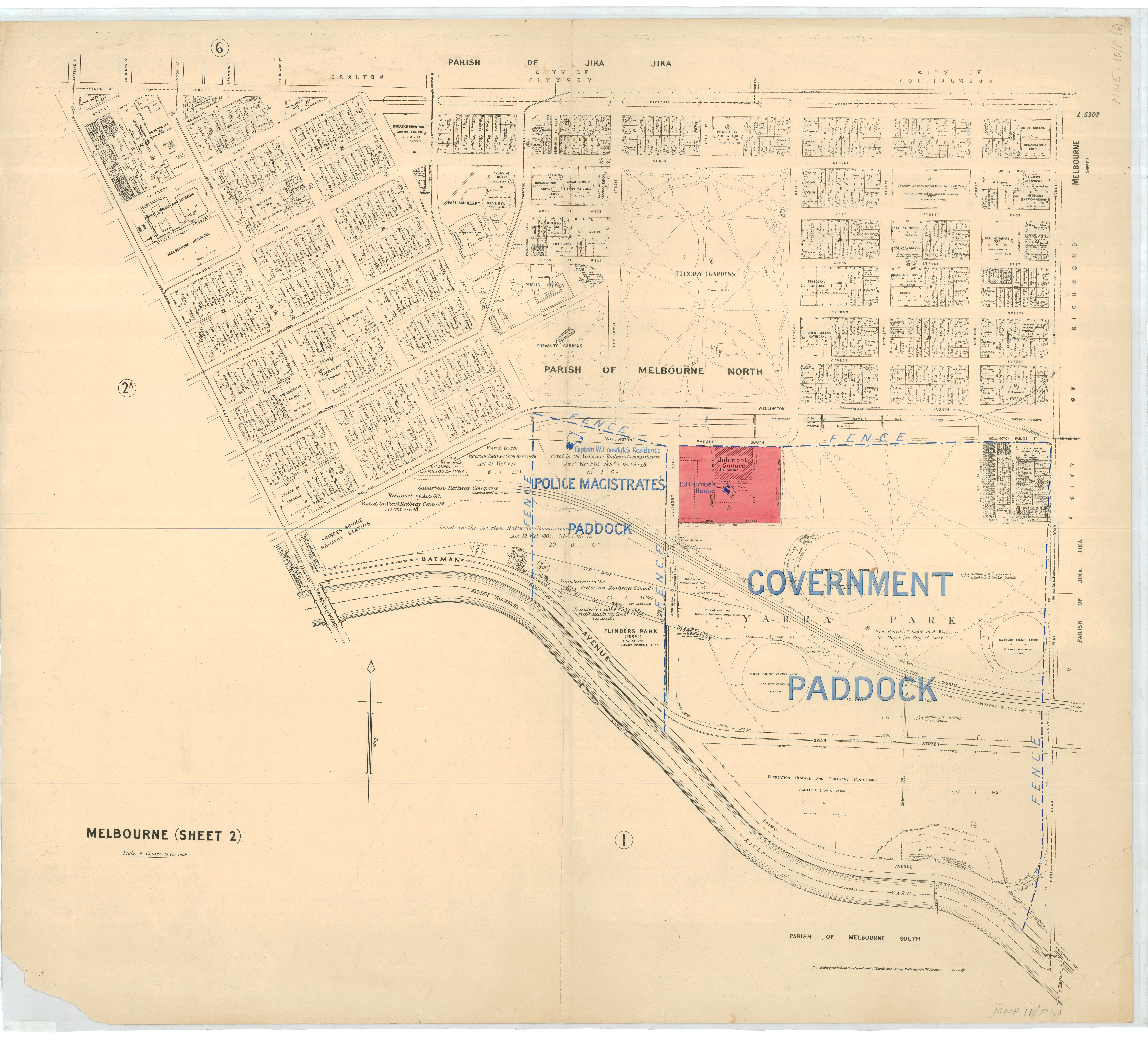
Plan file Parish map of Melbourne South c.1900.
Gives the names of first purchasers of all blocks of land.
Shows the Yarra River after it was straightened in the late 1890s and it shows the 1894 foot-bridge over the Yarra at Punt Road and the road for vehicle traffic on Punt Road to cross at the Anderson Street Morrell Bridge.
Item type:
Map
Item size:
92x84 cm
Item condition:
Fair
Date of publication or creation:
1900
Year acquired:
2008
Donor:
Dr. Elizabeth Rushen
Date digitised:
2010-02-26