Home

East Melbourne Historical Society

Drop-down menu

  • Articles
  • People
    • Notable Women
    • WW1 soldiers and nurses
    • WW1 nurses
  • History
    • Milestones
    • Buildings
    • Community
    • People
  • Gallery
    • Maps
    • MMBW plans
    • Abortion battles
    • Bishopscourt
    • Bishopscourt garden
    • Bomb shelter
    • Buildings
    • Cairns Memorial Church
    • Early Melbourne
    • Football
    • Jean Campbell
    • Lanes
    • Margaret McLean
      • Family and home
      • Female suffrage
      • Clippings - Australia
      • Clippings - Britain
      • Clippings - USA
    • Personalities
    • Yarra Park
      • History
      • Desecration
    • Yarra River
  • Catalogue
    • Browse and Search
    • Catalogue table view
    • Site images
  • Images
  • Society
    • Activities
    • Newsletters
    • Tributes
      • John Barrie Wykes
      • Wynne McGrath
    • Publications
      • Heritage Matters
      • What's in a Name
    • About
Home
    • Home
    • Search
    • Forum
    • Contact

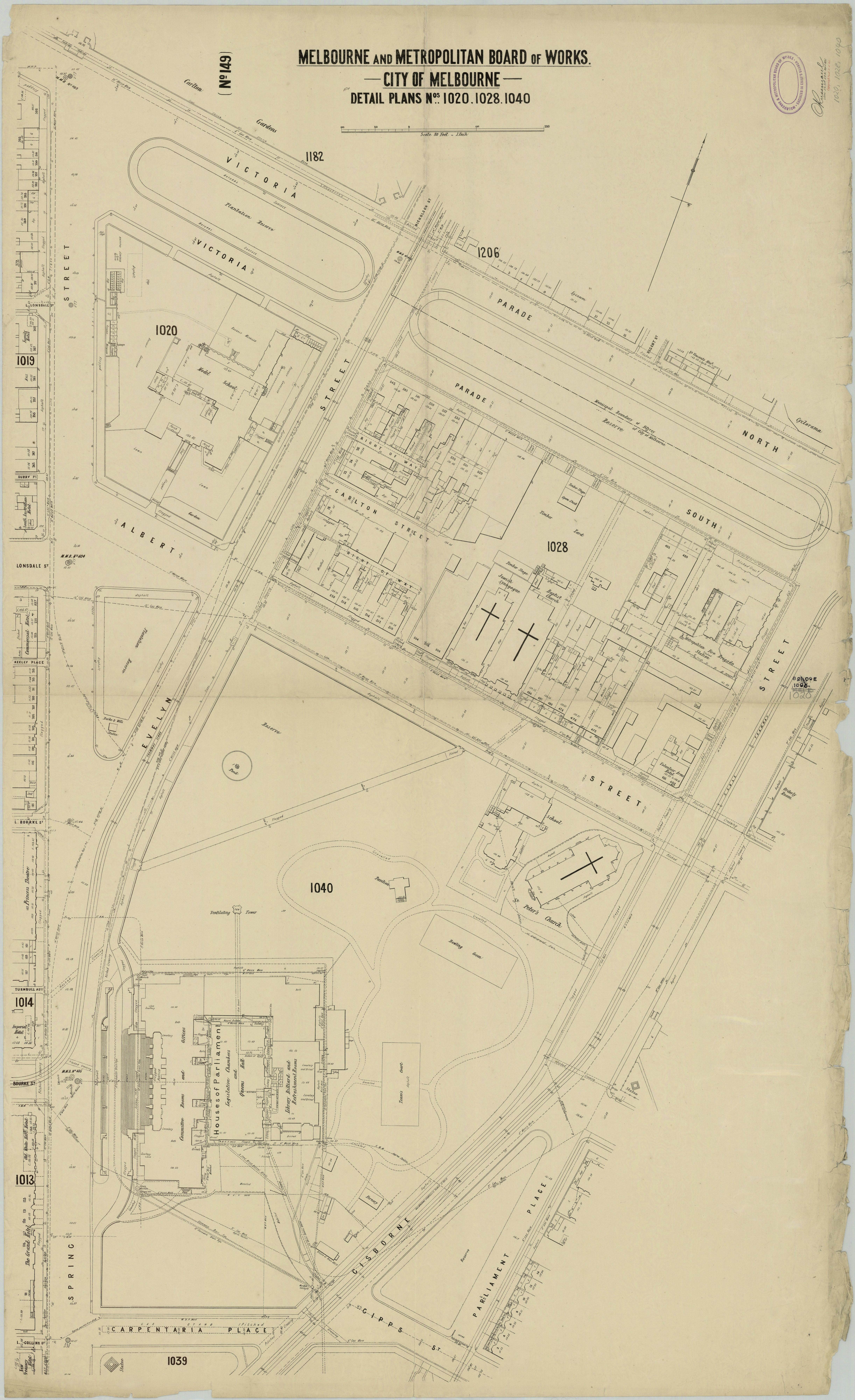
MMBW Plan - Spring St, Victoria Pd, Albert St, Gisborne St

  • first
  • ‹ previous
  • 1277 of 2369
  • next ›
  • last
Image
Move your mouse over image or click to enlarge
Acquisition number: 
809
Catalogue number: 
slvbw0011
File name: 
MMBW Plans
File location: 
Digital File

MMBW detailed plan of East Melbourne published in 1895 covering Victoria Parade North, Victoria Parade South, Gisborne Street, Parliament Place, Gipps Street (St Andrews Place), Carpentaria Place, Spring Street, Evelyn Street and Albert Street.

Item type: 
Map
Related content: 
Index to MMBW plans
Related content: 
East Melbourne plan
Related content: 
Adjoining plan east
Related content: 
Adjoining plan south-east
Item size: 
220x360 cm
Item condition: 
Fair
Item inscription: 

Melbourne and Metropolitan Board of Works detail plan 1020, 1028, 1040, City of Melbourne

Date of publication or creation: 
1895
Publisher: 
Melbourne Metropolitan Board of Works
Publication place: 
Melbourne, Victoria
History of item: 

Obtained from Maps Collection, State Library of Victoria

Reproduction rights: 
State Library of Victoria
  • 3500 reads
  • Share this
  • PrintPrint
  • EmailEmail

User login

  • Join EMHS
  • Request new password
  • Privacy
  • Membership
  • About
  • Contact
  • Guidelines