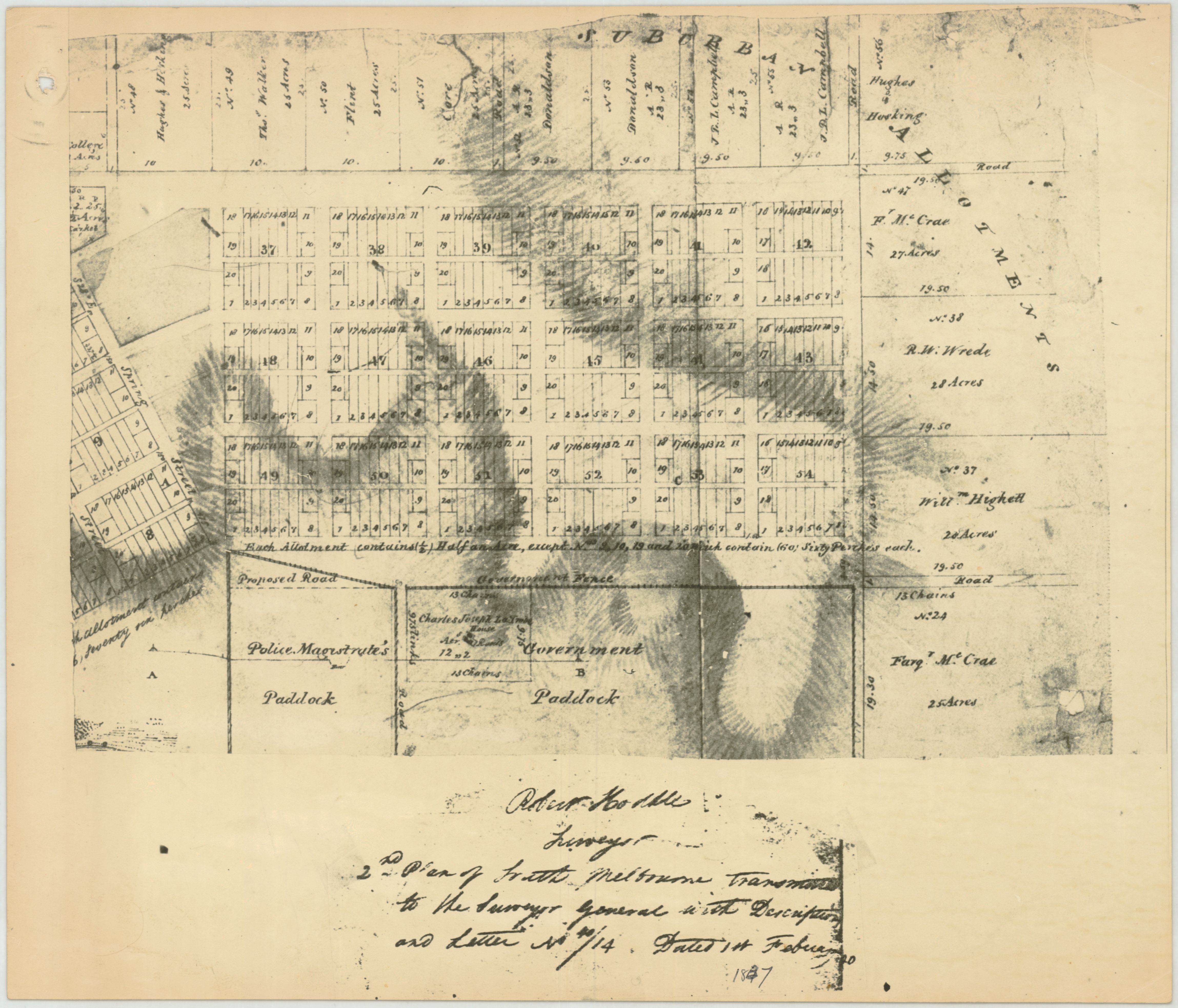
1837 East Melbourne Plan - Robert Hoddle
- first
- ‹ previous
- 1297 of 2412
- next ›
- last
Move your mouse over image or click to enlarge
Acquisition number:
810
Catalogue number:
eml0002
File name:
EML0002
File location:
East Melbourne Library Part of Robert Hoddle's survey of South Melbourne completed in 1837 showing proposed roads and allotments. The location of La Trobe's house is shown but allotments are shown in the areas which later became Fitzroy Gardens and other public and church lands.
Item type:
Map
Item size:
42x38 cm
Item condition:
Fair Item inscription:
Robert Hoddle
Surveyor
2nd Plan of East Melbourne Transmitted to the Surveyor General with Description and Letter No./14 dated 1st February 1837.
Date of publication or creation:
1837
Publisher:
Surveyor General of New South Wales
Date digitised:
2010-05-26