Home

East Melbourne Historical Society

Drop-down menu

  • Articles
  • People
    • Notable Women
    • WW1 soldiers and nurses
    • WW1 nurses
  • History
    • Milestones
    • Buildings
    • Community
    • People
  • Gallery
    • Maps
    • MMBW plans
    • Abortion battles
    • Bishopscourt
    • Bishopscourt garden
    • Bomb shelter
    • Buildings
    • Cairns Memorial Church
    • Early Melbourne
    • Football
    • Jean Campbell
    • Lanes
    • Margaret McLean
      • Family and home
      • Female suffrage
      • Clippings - Australia
      • Clippings - Britain
      • Clippings - USA
    • Personalities
    • Yarra Park
      • History
      • Desecration
    • Yarra River
  • Catalogue
    • Browse and Search
    • Catalogue table view
    • Site images
  • Images
  • Society
    • Activities
    • Newsletters
    • Tributes
      • John Barrie Wykes
      • Wynne McGrath
    • Publications
      • Heritage Matters
      • What's in a Name
    • About
Home
    • Home
    • Search
    • Forum
    • Contact

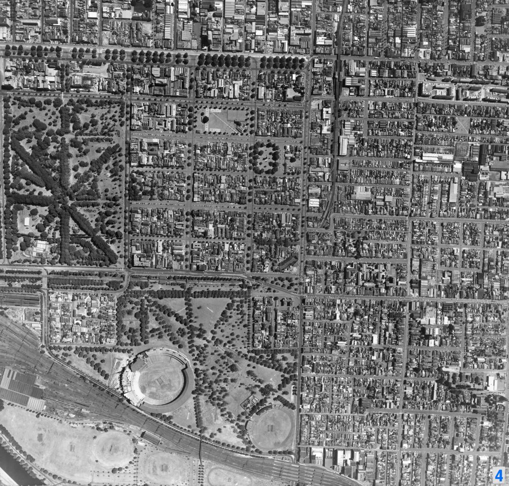
East Melbourne and Richmond aerial photo, 1967

  • first
  • ‹ previous
  • 2390 of 2391
  • next ›
  • last
Image
Move your mouse over image or click to enlarge
Acquisition number: 
1811
Catalogue number: 
emdf0498
File name: 
DF0498
File location: 
Digital archive

Aerial map of East Melbourne and Richmond taken in 1967.  

Some noticeable changes include: centre parking in Grey and Hotham Streets; the absence of paths in Darling Square; the building on the eastern edge of Powlett Reserve once used as a child care centre for 2 to 3 year-old, pre-kinder children.

See link below for information from City Collection's website

Item type: 
Map
External reference: 
City collection Image 4
Date of publication or creation: 
1967
  • 11 reads
  • Share this
  • PrintPrint
  • EmailEmail

User login

  • Join EMHS
  • Request new password
  • Privacy
  • Membership
  • About
  • Contact
  • Guidelines