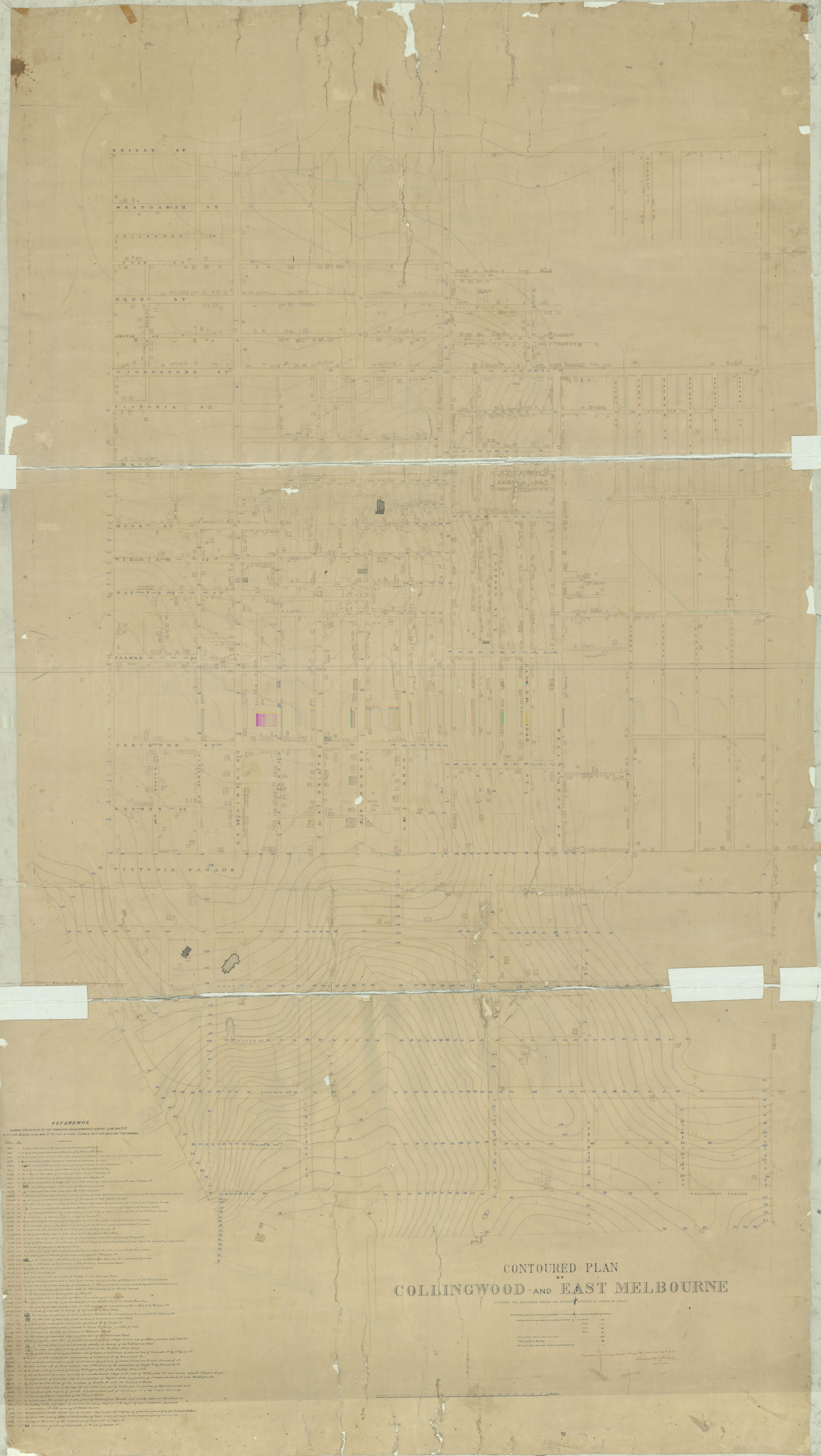
Contoured Plan Collngwood and East Melbourne 1853
- first
- ‹ previous
- 2371 of 2410
- next ›
- last
Move your mouse over image or click to enlarge
Acquisition number:
1792
Catalogue number:
emdf0485
File name:
DF0485
File location:
Digital archive This map is described as 'shewing the buildings facing the principal streets at the time of survey'. A handwritten note says 'Submitted to the Surveyor General with my letter dated Nov'r 29 1853'. It is signed Clement Hodgkinson, Surveyor.
The buildings shown are colour-coded according to building material.
The original map is in the collection of the Public Record Office of Victoria, in its Historic Plan Collection. Surveyor-General's Department: VPRS 8168/P0002 item MELBRL3
https://prov.vic.gov.au/archive/FDB74EAA-F858-11E9-AE98-83693D179613?ima...
Item type:
Map
Artist-illustrator:
Clement Hodgkinson
Date of publication or creation:
1853
Owner of original:
Public Record Office of Victoria